Featured Article
The Latest
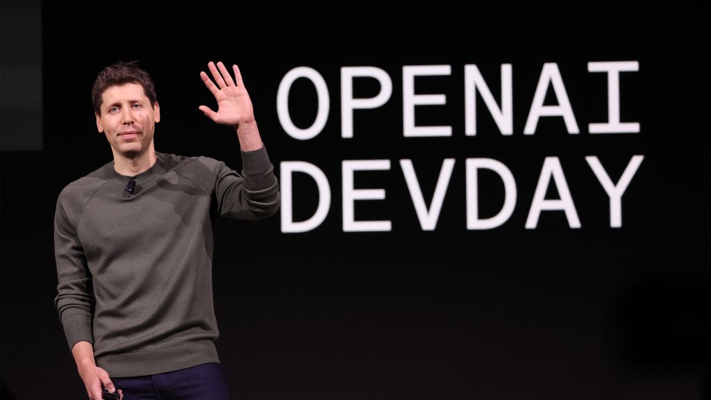
Welcome back to TechCrunch’s Week in Review. This week had two major events from OpenAI and Google. OpenAI’s spring update event saw the reveal of its new model, GPT-4o, which…

Expedia says Rathi Murthy and Sreenivas Rachamadugu, respectively its CTO and senior vice president of core services product & engineering, are no longer employed at the travel booking company. In…

When Jeffrey Wang posted to X asking if anyone wanted to go in on an order of fancy-but-affordable office nap pods, he didn’t expect the post to go viral.

AI
OpenAI created a team to control ‘superintelligent’ AI — then let it wither, source says
7 hours ago
OpenAI’s Superalignment team, responsible for developing ways to govern and steer “superintelligent” AI systems, was promised 20% of the company’s compute resources, according to a person from that team. But…

Transportation
VCs and the military are fueling self-driving startups that don’t need roads
8 hours ago
A new crop of early-stage startups — along with some recent VC investments — illustrates a niche emerging in the autonomous vehicle technology sector. Unlike the companies bringing robotaxis to…

Enterprise
Deal Dive: Sagetap looks to bring enterprise software sales into the 21st century
9 hours ago
When the founders of Sagetap, Sahil Khanna and Kevin Hughes, started working at early-stage enterprise software startups, they were surprised to find that the companies they worked at were trying…

Keeping up with an industry as fast-moving as AI is a tall order. So until an AI can do it for you, here’s a handy roundup of recent stories in the world…
After Apple loosened its App Store guidelines to permit game emulators, the retro game emulator Delta — an app 10 years in the making — hit the top of the…

Meta is once again taking on its competitors by developing a feature that borrows concepts from others — in this case, BeReal and Snapchat. The company is developing a feature…
Startups
Startups Weekly: It’s the dawning of the age of AI — plus, Musk is raging against the machine
1 day ago
Welcome to Startups Weekly! We’ve been drowning in AI news this week, with Google’s I/O setting the pace. And Elon Musk rages against the machine.

Where we’ll be next
Oct 28th
TechCrunch Disrupt 2024
San Francisco, CA
Jun 11th
StrictlyVC – Washington, D.C.
Washington, D.C.
May 21st
StrictlyVC – London
London
IndieBio’s Bay Area incubator is about to debut its 15th cohort of biotech startups. We took special note of a few, which were making some major, bordering on ludicrous, claims…

YouTube TV has announced that its multiview feature for watching four streams at once is now available on Android phones and tablets. The Android launch comes two months after YouTube…

Featured Article
Two Santa Cruz students uncover security bug that could let millions do their laundry for free
CSC ServiceWorks provides laundry machines to thousands of residential homes and universities, but the company ignored requests to fix a security bug.
1 day ago

Decks are all about telling a compelling story and Goodcarbon does a good job on that front. But there’s important information missing too.

TechCrunch Disrupt 2024 is just around the corner, and the buzz is palpable. But what if we told you there’s a chance for you to not just attend, but also…

Media & Entertainment
TechCrunch Minute: Here’s why the video portal between NYC and Dublin shut down
9:00 AM PDT • May 17, 2024
If you were planning to check out the Portal, we have some bad news: The 24-hour livestream installation connecting Dublin and New York City has…

Slack is making it difficult for its customers if they want the company to stop using its data for model training.

A Texas-based company that provides health insurance and benefit plans disclosed a data breach affecting almost 2.5 million people, some of whom had their Social Security number stolen. WebTPA said…

Featured Article
Microsoft dodges UK antitrust scrutiny over its Mistral AI stake
Microsoft won’t be facing antitrust scrutiny in the U.K. over its recent investment into French AI startup Mistral AI.
1 day ago

Startups
AI’s busy week, and why the heck are so many VCs leaving their firms?
7:10 AM PDT • May 17, 2024
If there was one thing we heard about this week, it was AI. As a matter of fact, there were so many AI updates to…
